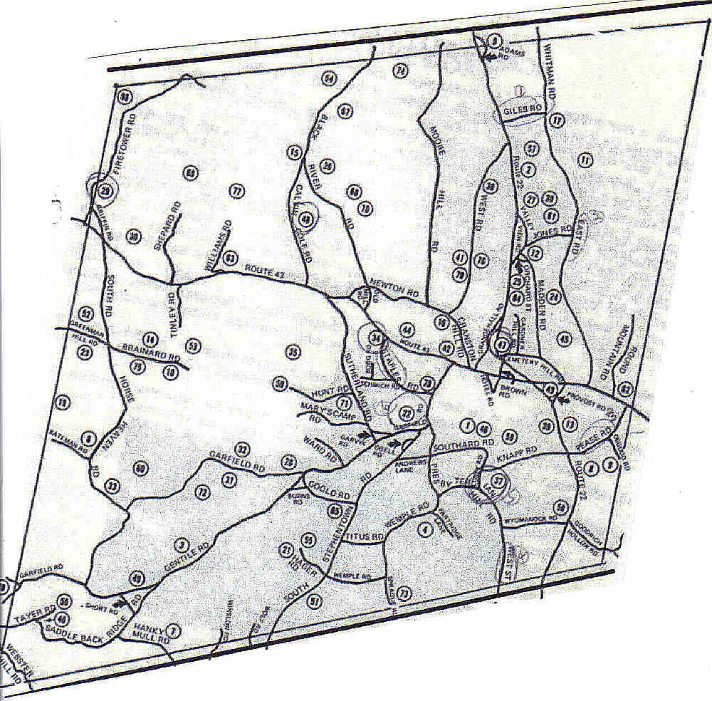
Cemmap2.jpg
From Stephentown Genealogy: Roots & More
Size of this preview: 609 × 599 pixels. Other resolutions: 244 × 240 pixels | 488 × 480 pixels | 610 × 600 pixels | 1,000 × 984 pixels.
Original file (1,000 × 984 pixels, file size: 136 KB, MIME type: image/jpeg)
This map corresponds with the listing of cemeteries. Each cemetery is numbered and there is a number that corresponds with that cemetery on the map.
File history
Click on a date/time to view the file as it appeared at that time.
| Date/Time | Thumbnail | Dimensions | User | Comment | |
|---|---|---|---|---|---|
| current | 19:59, 10 February 2019 | | 1,000 × 984 (136 KB) | Nnett (talk | contribs) |
- You cannot overwrite this file.
File usage
The following page links to this file: